Forest Fire Fieldwork
by Josephina Matibag
This summer, I dabbled in scientific fieldwork for the first time and l want to share my experience to broaden people’s knowledge on what it entailed. My name is Josephina Matibag, and I am an undergraduate student at Colorado State University studying Natural Resources Science. I worked as a student summer intern with the North Central Climate Adaptation Science Center at the University of Colorado Boulder, which led to my first experience in fieldwork.
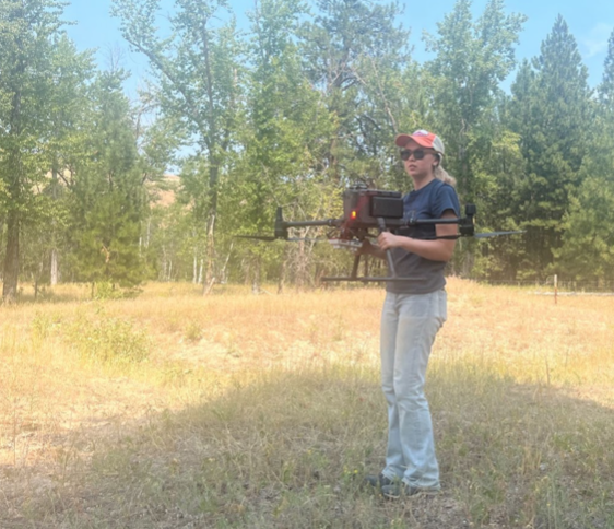
My specific work uses remote sensing data, such as satellites and imagery collected via airplanes, to understand the impacts of forest fires on forest carbon recovery (where the latter is the intake of carbon by trees within a forest). The fieldwork involved flying drones to collect imagery of ecosystems once impacted by forest fires. Then we used the imagery to survey the area for different plant functional types (e.g., whether something is a bush, tree, or a flower). The ultimate objective is to understand the resilience of western US forests to increased wildfire severity, drought, and beetle kill.
As someone who, for the majority of their time worked in the field, collecting data, it is difficult to see the correlation between the work I do and the results of my project. Everything that occurs after my job, such as data processing and analysis, is what explains our results. That’s not to say that fieldwork isn’t important as, without the data, there would be nothing to analyze. There is value in every process of the scientific method and field work quickly became one of my top interests.
I found it incredibly engaging to work in the field. There is so much problem-solving that must occur: sometimes it is too cloudy for us to fly so we must adjust the plan or sometimes there is a software issue that must be fixed on the spot despite the lack of a wifi connection in the wilderness. There is never going to be a way to predict what will happen in the field, so I enjoyed learning to adapt to challenges.
Working outside versus in a cramped office is a huge benefit, but you also have a greater responsibility to take care of yourself while outdoors. One of the days this summer we were working in 102 degree Fahrenheit heat and the importance of hydration and breaks was emphasized. If we cannot do our work due to a heat stroke or other illnesses related to long hours outdoors, it puts a severe damper on the project. Our drone can only fly in clear conditions, which limits the amount of time out of the year that we can collect data. Thus, it is important to be at our best when we can fly so data collection can run smoothly.
Overall, engaging in field research this summer was an incredibly rewarding opportunity that I believe more people should experience. And don’t forget the best part: the views!
Fun Fact: Drone Dance
Did you know that to calibrate the drone in the field we have to do something called a drone dance? This consists of holding the drone out from your body and spinning in a circle. You reorient the drone in different directions, nose up, nose down, left wing up, etc., and continue spinning. The purpose of drone calibration is to ensure the drone knows which direction is up, down, left, right, etc. so it can fly safely in the right direction!


