James Rattling Leaf Helps Standing Rock Sioux Tribe Host Climate Change Summit
NC CASC Publication on Drought Decision Making Highlighted by NCASC News Announcement
NC CASC Welcomes New Communications Specialist, Ulyana Horodyskyj
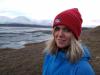
Ulyana Horodyskyj Peña
Read the Latest NC CASC Tribal Climate Newsletter
Aparna Bamzai-Dodson to Speak at Upcoming INSTAAR Seminar
Read the latest NC CASC publications
One of the most visible signs of climate change is less mountain snow. In the Western U.S., deep snow has historically been a cornerstone of life for many plants and animals. For example, snow can provide denning shelter for certain species like the wolverine, and snowmelt provides dependable water to mountain streams that are home to fish like the bull trout. Yet snow losses driven by warming temperatures are already causing land and water managers to rethink whether certain species can thrive in the future. A recently completed study by this research team helped the U.S. Fish and Wildlife Service investigate whether wolverines will have enough snow to survive in two areas of the Rocky Mountains. In June 2020, the project team gathered a large group of regional land managers at a “Snow Collider” workshop event to learn about the wide range of needs for future snow information. Managers identified needs focused on how much snow will be around in the future, as well as how that snow will melt to support streams. This input will guide the direction of the future snow modeling in this study. The main goal of this project is to build better models of future snow conditions for the key areas of the Rocky Mountains identified previously. The team seeks to understand whether changes in future snowpacks will be sufficient for key species to thrive. This research will zoom in to model future snow conditions at much higher resolutions compared to earlier studies, to allow for an improved method to understand how snow will accumulate and melt across landscapes. This project aims to help managers make more informed decisions about future snow dependent species and choose the most effective ways to allocate resources towards recovery plans and monitoring.
Contact Us
Want to see more? Do you have feedback? Was this site helpful? Send us an email!