When
James Rattling Leaf Presenting at Second Lakota Food Summit 2022
NC CASC PI James Rattling Leaf will present "Developing Tribal Strategies to Deal with a Changing Climate" at the Second Lakota Food Summit on February 17th.
New Publication by James Rattling Leaf: "What is Traditional Ecological Knowledge and why does it matter?"
NC CASC PI James Rattling Leaf has published a new paper in ESA's Frontiers in Ecology & the Environment titled "What is Traditional Ecological Knowledge and why does it matter?"
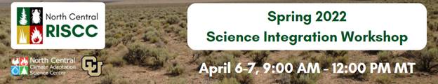
North Central Regional Invasive Species and Climate Change (NC RISCC) to Host Science Integration Workshop

New Publication by Brian Miller: "Conservation under uncertainty: Innovations in participatory climate change scenario planning from U.S. national parks"
NC CASC/USGS Research Ecologist Brian Miller is the primary author of a new publication, "Conservation under uncertainty: Innovations in participatory climate change scenario planning from U.S. national parks".
Phil Higuera Co-authors New Paper, "Developing strategies to support social-ecological resilience in flammable landscapes: A structured approach for natural resource managers and other stakeholders"
NC CASC consortium partner, Phil Higuera, University of Montana, is co-author on a new paper, "Developing strategies to support social-ecological resilience in flammable landscapes: A structured approach for natural resource managers and other stakeholders". The paper is a product of the USDA/US Forest Service Joint Fire Science Program.
Brian Miller to Present at the Center for Geospatial Analytics at North Carolina State University
On February 24th, Brian Miller, NC CASC Research Ecologist, will be giving an invited presentation to the Center for Geospatial Analytics at North Carolina State University as part of their 2021-22 Geospatial Forum series.
Brian Miller Co-author on New Publication: "Increasing the Uptake of Ecological Model Results in Policy Decisions to Improve Biodiversity Outcomes"
NC CASC/USGS Research Ecologist, Brian Miller, is co-author on a new publication in Environmental Modelling and Software, "Increasing the uptake of ecological model results in policy decisions to improve biodiversity outcomes".
NC CASC February Tribal Climate Newsletter Now Online
The NC CASC February 2022 Tribal Climate newsletter is now available online.
Contact Us
Want to see more? Do you have feedback? Was this site helpful? Send us an email!